
Fuhrmann, Thomas: Forschung und Projekte
DFG Project: Vertical crustal movements in the Upper Rhine Graben area derived from precise levelling, SAR interferometry and GNSS
1. Project phase: 04/2010 - 04/2012
Consistent transnational analysis of levelling data in the URG region measured by German, French and Swiss surveying agencies.
Objective: Derivation of vertical displacement rates at levelling benchmarks from a kinematic adjustement of levelling measurements.
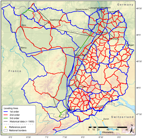
Analysed levelling network:
Project partners (data supply):


2. Project phase: 01/2013 - 01/2015
Analysis of SAR data acquired by ESA's satellites ERS-1/2 and Envisat using Persistent Scatterer SAR Interferometry (PS-InSAR).
Objectives: Derivation of displacement rates from PS-InSAR analyses in the URG region. Comparison, Validation and Combination with results obtained from levelling and GNSS analyses of the GNSS Upper Rhine Graben network GURN.
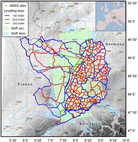
SAR footprints, GNSS sites and levelling network in the URG region:
ERS-1/2 and Envisat SAR data provided by:
![]()
Presentation given at the 74th annual meeting of the German Geophysical Society (DGG): Download